Beaufort Riverine & Stormwater Flood Risk Investigation
Glenelg Hopkins CMA is currently undertaking a new flood investigation for Beaufort in partnership with Pyrenees Shire Council and with support from the Victorian Government.
Water Technology has been engaged to deliver the new flood risk mapping. The new mapping will account for the floods that have happened since 2008 when the last full investigation was completed. The new mapping will also account for the effects of climate change.
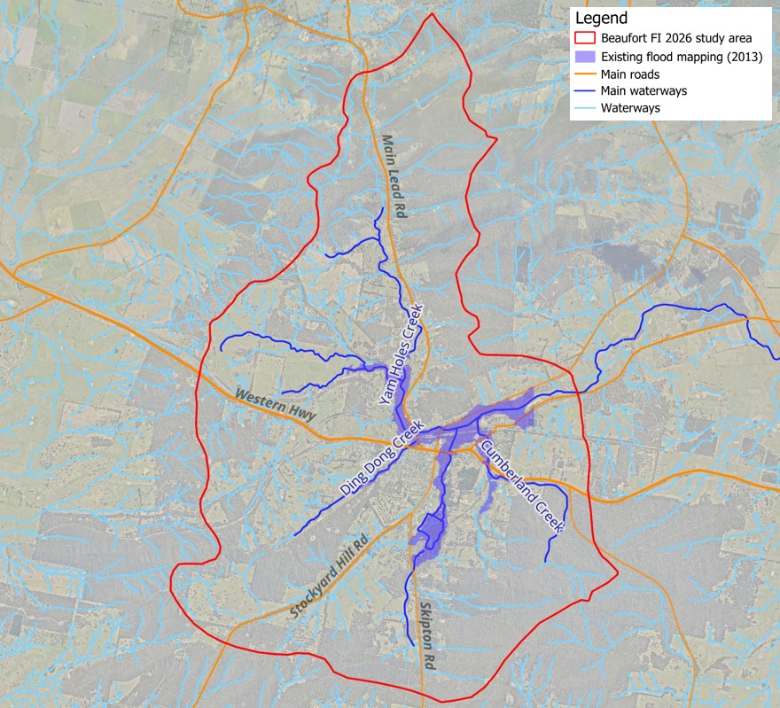
The area of the investigation will extend approximately 6km north up Yam Holes Creek, and include Garibaldi, Cumberland and Ding Dong Creeks across the south. The red boundary in the map below shows the area that will be covered.
Project timeline
Catchment tour (Pyrenees SC, GHCMA and Water Technology)
Project inception meeting
Data review
PRG meeting & Community session #1
Draft flood modelling
PRG meeting & Community session #2
Final flood mapping
Planning Scheme Amendment mapping
Flood damages & Mitigation assessment
PRG meeting & Community session #3
Flood emergency response & resilience information
Project summary report
PRG meeting & Community session #4
Call for community knowledge
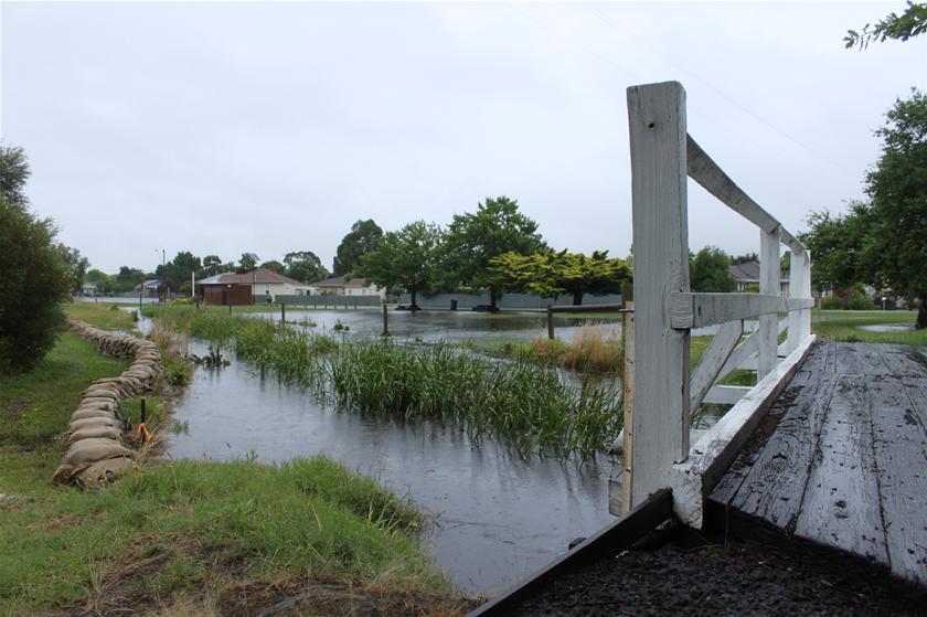
The impacts of flooding can range from minor and major transport disruptions when roads get flooded, through to stock, crop and fencing losses, damage to homes and shedding and in the most serious circumstances, loss of lives.
An initial focus of the project is to gather community’s knowledge and experience of flooding in the area, and to use this knowledge to ensure the maps produced by the computer model show what we can expect in real life.
Did you know?
Historical records, including photos, flood levels – even those community or household ones like a nail in a post or a mark on a wall, and rainfall records, that you have kept individually or as a family – can be a big help ensure the new flood maps are reliable.
It all helps to back up, support and provide an alternate view of flood data.
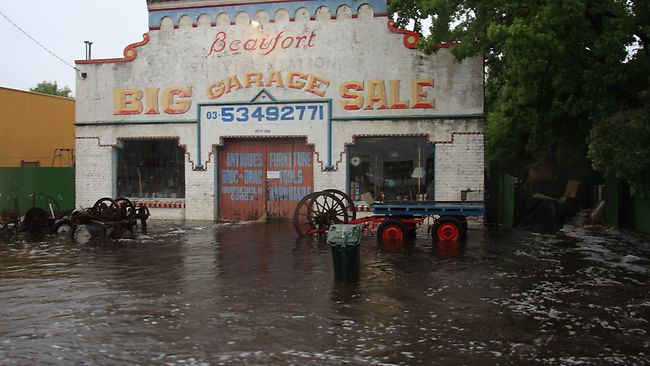
ABOVE: Beaufort, January 2011 (Margaret Burin, ABC Ballarat).
Interested in learning more?
Our first community information session will be held on the 1st of April in Beaufort.
Location: Beeripmo Centre, 1-3 Lawrence St, Beaufort.
Time: 2:30-6:00pm.
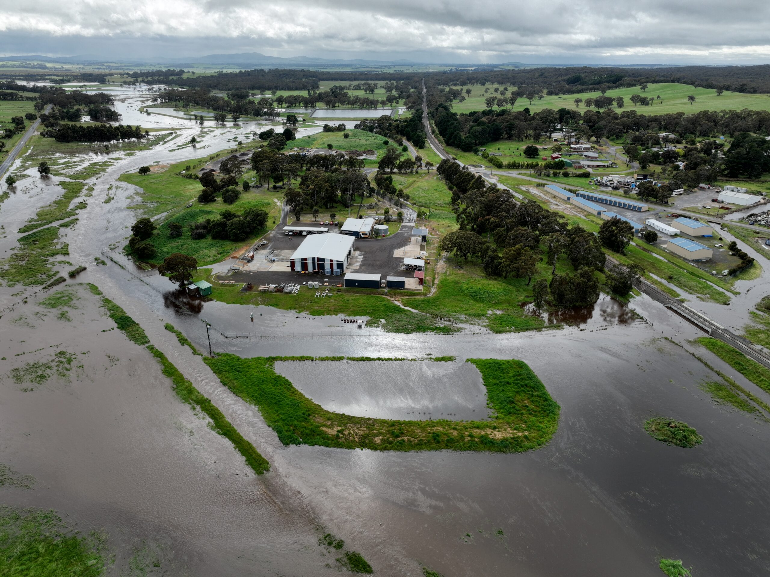
Above: DEECA depot Beaufort, looking east. October 2022 (DEECA)