Updated floodplain management arrangements for Victoria
The following information has been provided to the Glenelg Hopkins CMA by the Victorian Government in relation to changes to the Flood Planning Scheme announced by the Victorian Government on October 3, 2025.
Please take the time to read through these questions and answers in relation to the changes to see if your inquiry around development has been answered here.
Please note: There is a two year phase in period for these changes.
What is being delivered?
The Victorian Government is committed to providing the best available flood risk information to communities.
Floodplain Management Authorities now have stronger accountabilities to prepare and endorse flood mapping. New and improved flood-related planning and building controls will also be introduced faster.
Property specific risk rating information is to be developed and made publicly available.
We’re also developing better guidance on how to design and plan flood-resilient development.
Still wanting to know more about how this will impact your property in the Glenelg Hopkins Catchment area?
Additional information around floodplain planning and mapping is available via our Floodplain Flood Advice page where access to the Flood Portal is available (please note the limitations of this in relation to some newly developed mapping).
If you have read through these Q&As and accessed the webpage above, and still have questions, please contact our team via email: planning@ghcma.vic.gov.au
Q&A about the Floodplain Management changes
Awareness of flood risk is not consistent across the community.
Inconsistent information creates uncertainty, development in higher risk areas, and underinsurance by households.
Providing households with better property level flood information enables them to make more informed choices to plan and prepare for a flood, including evacuation plans, adequate insurance coverage and flood resilient home design.
Plan for Victoria commits to better identify flood risks and communicate them to the community. The changes are practical and respond to:
- learnings from the Flood Reclamation Roadmap project announced in May 2023.
- findings and recommendations from the 2022 Victorian Flood inquiry including hearings and submissions.
- recent research, national climate risk assessments, and strategies.
- community and industry submissions to planning reform and Plan for Victoria.
Australia’s National Climate Risk Assessment (2025) and the Victoria’s Climate Science Report 2024 shows that our climate is changing and will continue to change into the future.
Increased rainfall intensity and more frequent and severe flooding will impact our communities, including areas where people and places haven’t experienced these hazards before.
It will not be safe or appropriate to build homes in some areas.
We need to take action now to identify and plan for these higher risk areas to ensure infrastructure and built environment including homes can adapt to change.
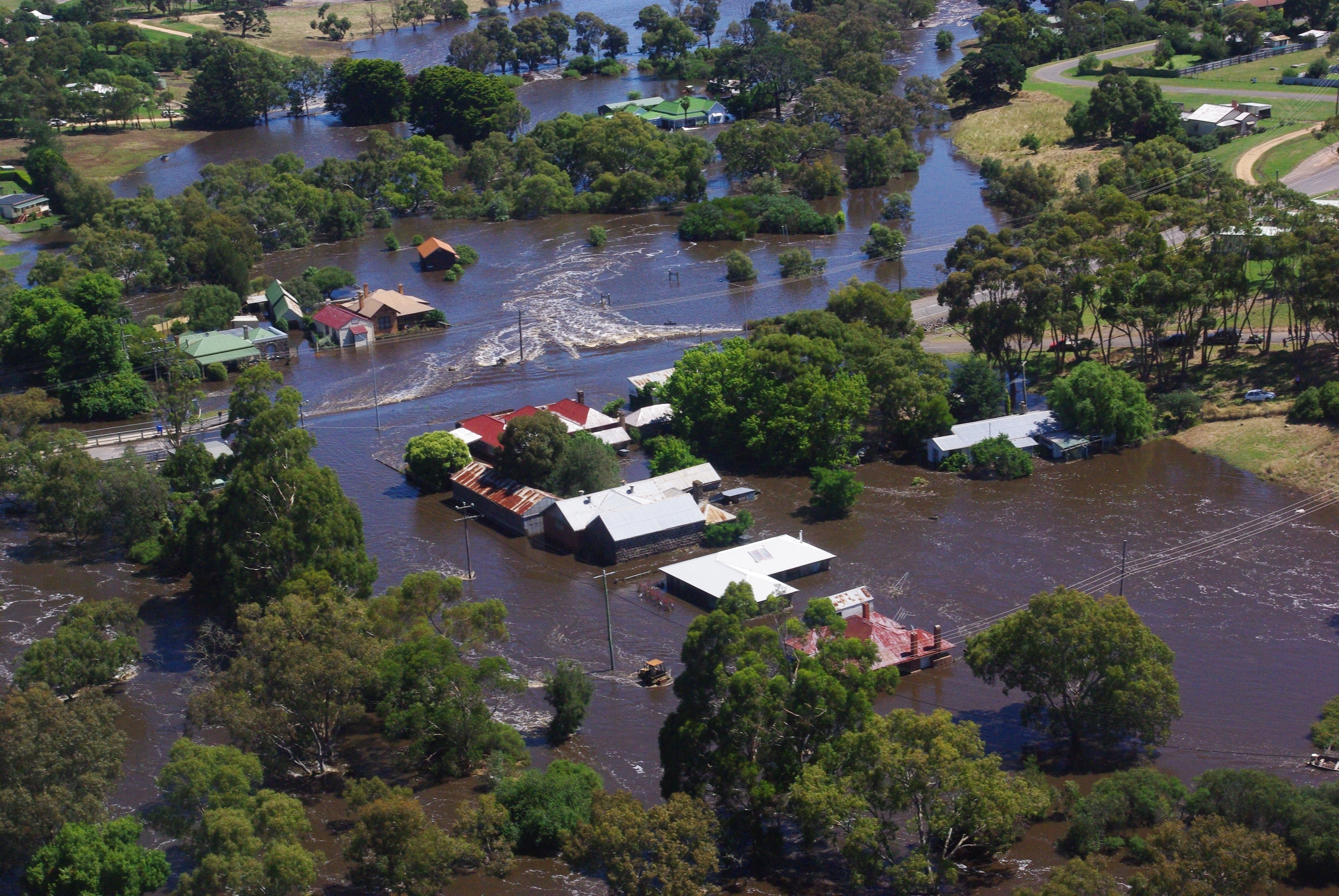
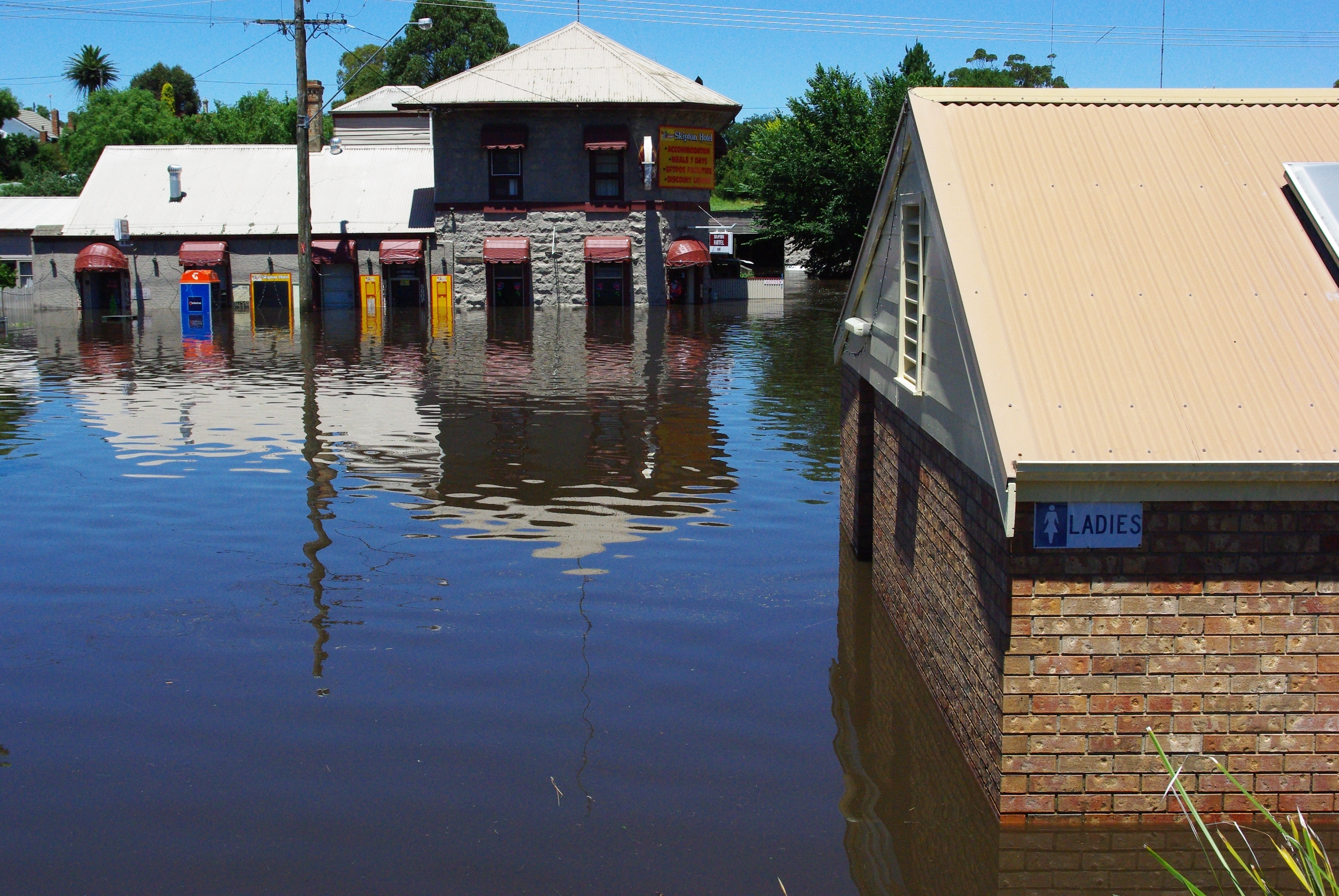
Flood models identify which areas are most likely to flood, how quickly, and how deep the water may get.
They don’t create flood risk but help us better understand the risk that a community faces, now and in the future.
A flood with a one per cent probability of occurring each year is the standard for development decisions across Australia. Thousands of properties across Victoria are within this flood extent, and not all have existing planning and building controls. These households may not be aware of this existing risk.
As the climate continues to change, flood risk mapping and controls on floodplain development will need periodic review and update to enable informed risk management decisions.
The Victorian Government is continuing to invest in updating flood models to account for the impacts of climate change and changes to flood behaviour as a result to flood mitigation investment and population growth.
The changes announced will ensure these flood models can be updated more quickly in future and will ensure that existing planning and building controls reflect the best available flood risk information and enable faster decisions.
Floodplain Management Authorities such as Melbourne Water and Catchment Management Authorities will engage local communities as flood studies are undertaken. Existing flood information is publicly accessible and available for all of Victoria on Digital Twin Victoria.
The Government is launching a new online campaign called Are You Covered? to raise awareness about the importance of having home insurance that best suits homeowners’ needs. The campaign aims to build the financial resilience of Victorian homeowners to extreme weather events.
Property specific flood risk information is also available via the Glenelg Hopkins CMA website Floodplain Management page and more specific information via the Regional Flood Portal.
Flood risk information is important when purchasing a home, as buyers are responsible for undertaking due diligence including accepting a level of risk related to site condition, planning controls and natural hazards.
The new approach will see flood mapping prepared with property specific hazard risk rating levels, giving homeowners more information about their specific risks, ensuring all Victorians will have a greater understanding of the risks to help ensure more transparent pricing in the property market and competitive insurance premiums.
Information provided by online flood mapping tools and other sources such as local flood guides, can improve flood resilience of communities by preventing inappropriate development and enhancing individual preparedness for and responses to floods.
This reduces residual flood risks including loss of life, property damage and associated social and economic impacts.
Insurance challenges are growing. Rising premiums, driven by climate change, are exceeding income growth, leaving many underinsured or properties uninsurable.
A key obstacle in addressing insurance affordability is the limited public access to critical flood risk information. Providing this information will enable more transparent and competitive insurance policies.
Some properties may find insurance premiums increase, or insurance is inaccessible, because of the high or very high hazard ratings on their land. Equally, some properties may find that insurance is more accessible due to the better information provided by moderate or low hazard ratings.
The application of hazard ratings to planning and building controls will provide residents and industry with a better understanding of flood risk and development potential. Development can still occur in many flood prone areas, subject to meeting appropriate design, construction and flood protection measures. This is similar to the approach to managing bushfire risk.
Development of new housing will be informed by better guidance on how to design and plan flood-resilient development in urban areas. Guidance will also support residents to rebuild after a flood. The hazard ratings will help to inform household decisions and to design relief and recovery supports after a flood event.
Uncertainty around flood risk impacts household flood preparedness, market confidence and housing growth. The application of consistent hazard ratings will provide transparent information and ensure that land values are proportionate to the risk. As new homes are built to the right standard, the impact will decrease over time including insurance premiums.
In areas with low flood risk, developments will only need to manage flood risk through the building system, avoiding the unnecessary delay of a planning application. This will provide more certainty and fast track housing in the right locations.
For all but areas with higher hazard ratings, risk-based controls will enable appropriate development that responds to the flood risk providing landowners and industry with certainty about what housing can be built where
and how.
Updated flood risk information in Greater Melbourne and Regional Victoria supports housing growth and investment by identifying areas for appropriate development through strategic planning and flood resilient design.
Where there is a low flood risk, we need to ensure the building of houses can continue and development can occur with minimal changes. This will provide certainty to the building industry and the building surveyors who issue the building permits.
Flood maps are prepared with the best available data, models and technical information.
Changes in the catchment, climate variables and projections, mapping techniques, urban development, infrastructure investment and other changes mean that the maps require updating over time.
A review of the Victorian Floodplain Management Strategy (VFMS) and Victorian Flood Data and Mapping Guidelines will incorporate an agreed, practical standard for a regular review cycle for flood studies.
In some areas, where conditions remain relatively unchanged and a review may conclude that updating the model is a lower priority. A major flood may trigger a review and update of the model outside of the agreed review cycle.
In Greater Melbourne, all flood models are being updated. Melbourne Water have committed to ongoing reviews every 5 years and update every 10 years, consistent with the Independent Review Panel in 2024.
The changes will be implemented over two years with transitional provisions, advice and community engagement.
Existing development approval can proceed in accordance with the permit conditions and construction standards.
Updated flood information will inform insurance premiums and should be considered in development decision. Households should always check with floodplain managers for the latest advice if uncertain.
The best available flood risk information is publicly available in Digital Twin Victoria and is provided by Floodplain Management Authorities such as Melbourne Water and Catchment Management Authorities. This flood risk information is consistent with the Insurance portal and the data used by emergencies services.
Floodplain Management Authorities will engage with local communities and emergency services as new flood studies are undertaken to review and update data in these spatial platforms and engage with Department of Transport and Planning to ensure planning and building controls are aligned.
Insurers calculate home insurance premiums based on a variety of factors, including the value of a home and contents, the location, and the type of cover selected.
Other factors that can influence a premium include claims history, the level of excess, any discounts, as well as the insurance 10% duty paid to the State Revenue Office.
The Victorian Government has made significant investment to reduce the risks of floods in a changing climate including $37.50 million to 2028 to continue implementation of the Victorian Floodplain Management Strategy and nine regional floodplain strategies including flood studies and priority flood mitigation projects.
Floodplain management authorities already provide technical support to councils in the preparation of flood models. The changes strengthen their accountabilities to lead flood models including community engagement.
DEECA is supporting floodplain management authorities to test the application of these changes and to inform development of guidance.
The incorporation of the reforms into the current flood studies will be assessed by floodplain management authorities and councils to determine the most appropriate delivery arrangements with a two-year transition period.
There is a backlog of regional flood models that are awaiting council-led planning scheme amendment.
The Department of Transport and Planning will administer a two-year transition process for the backlog of the completed flood studies that are not eligible to enter the new State-led amendment process because they either do not incorporate updated flood-hazard ratings or have not been subject to an adequate level of community engagement.
Victoria’s Resilient Coast – Adapting to 2100+ provides a framework, guidelines and support for local government, land managers and their communities to enable place-based, best practice and long-term coastal hazard risk management and adaptation.
The Victoria Planning Provisions Clause 13.01-2S and guidance require consideration of the state’s sea level rise planning benchmark and the Victorian Future Climate Tool by the Victorian Managed Insurance Authority (VMIA) can assist statutory planners with decisions under planning schemes where there may be coastal hazard impacts, such as inundation and erosion, that are not captured in existing planning scheme overlays.
No. The changes won’t have an immediate impact on local decisions or projects.
Catchment Management Authorities will continue to provide the best available flood risk information to inform technical advice to emergency services, authorities and communities.
Flood data varies widely across the state. There has been significant public investment into regional flood studies, flood mitigation infrastructure feasibility assessments and flood-related planning scheme amendments.
Existing flood studies and planning scheme amendments should continue under existing funding arrangements and planning controls to provide certainty to industry, stakeholders, consultants and communities.
The Victorian Government will engage with Catchment Management Authorities and communities to ensure a consistent approach to implement the reforms over the next two-years, including updated guidance, expectations, and standards to inform local decisions. The reforms will help to shape longer term regional and local priorities and investment.
Example: Abandoned South Warrnambool and Dennington Flood Investigation
The Victorian Government and Australian Government co-funded the South Warrnambool and Dennington Flood Investigation. The flood study was completed in December 2024 following significant community consultation.
Glenelg Hopkins CMA provided technical expertise and project management support to Warrnambool City Council to deliver the project.
The CMA has continued to provide the best available flood risk information and advice to inform land use and emergency management planning. There is no immediate impact on local planning decisions from the recent state announcement.
Glenelg Hopkins CMA will continue to engage with relevant authorities, councils and communities to plan and deliver the important changes over the next two years to improve community resilience to flood risk. This may include a future planning scheme amendment process for the South Warrnambool and Dennington Flood Investigation.
No. There has been significant public investment into regional flood studies, flood mitigation infrastructure feasibility assessments and flood-related planning scheme amendments. Many of these regional projects involve extensive technical investigations by consultants, community engagement and statutory processes.
Existing flood studies and planning scheme amendments should continue under existing funding arrangements and planning controls to provide certainty to industry, stakeholders, consultants and communities.
Any change to delivery or decisions on these existing projects may delay flood risk information being provided to communities, emergency services and households creating unnecessary risk to communities.
The Victorian Government will engage with authorities and communities to ensure a consistent approach to implement the reforms including transitional provisions, advice, community engagement and updated guidance.
Example: New flood studies in Corangamite region
The Victorian Government has invested in multiple flood studies projects in the Surf Coast Shire and Colac Otway Shire including Aireys Inlet, Anglesea and Apollo Bay.
Corangamite CMA provided technical expertise and project management support to deliver these projects with significant local collaboration, information sharing and engagement.
Corangamite CMA has continued to provide the best available flood risk information and advice to inform land use and emergency management planning.
There is no immediate impact on local project or planning decisions from the recent state announcement.
These flood studies should continue under current existing funding arrangements and planning controls to provide certainty to industry, stakeholders, consultants and communities.
Any change to delivery or decisions on these existing projects may delay flood risk information being provided to communities, emergency services and households creating unnecessary risk to communities.
The Victorian Government will engage with authorities and communities to ensure a consistent approach to implement the reforms including transitional provisions, advice, community engagement and updated guidance.
Yes. New funding will continue to be invested into regional floodplain management strategy priority flood studies, flood mitigation infrastructure feasibility assessments and flood-related planning scheme amendments.
This funding will be provided with flexible arrangements to progress investigations and enable collaborative engagement between authorities.
Yes. Local council will continue to have an important role in reducing flood climate risk to communities including:
- advise on building requirements relevant to flood risk
- provide knowledge, data, information to inform flood models
- drainage management functions on council land
- maintain flood mitigation infrastructure (e.g. levees)
- develop local planning policy and assess permits
- emergency planning and preparedness
- enforce the planning systems
Example: North East CMA region
The Victorian Government has invested in 2 projects in Alpine Shire. North East CMA provided technical expertise and project management support to deliver these projects with significant local collaboration, resource sharing and engagement.
The CMA has continued to provide the best available flood risk information and advice to inform land use and emergency management planning.
There is no immediate impact on local project or planning decisions from the recent state announcement.
North East CMA will continue to engage with relevant authorities, councils and communities to plan and deliver the important changes over the next two years to improve community resilience to flood risk.
Councils will continue to provide knowledge, data, information to inform future flood studies and planning scheme amendments and have a strong role in reducing flood climate risk to communities.