Flood Recovery
2022 – 2023 flood event
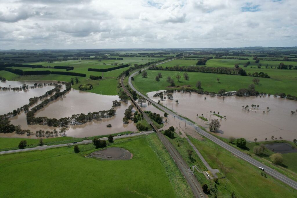
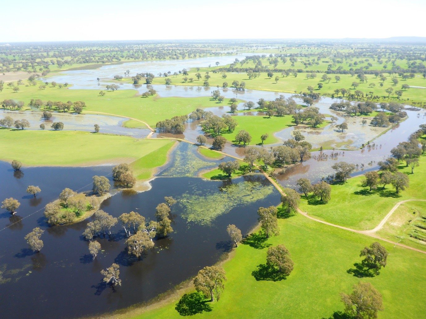
Beginning on 6 October 2022, Victoria experienced intense and heavy rainfalls over an extended period, which resulted in significant flooding in central and north central regions of the state and minor flooding elsewhere in Victoria.
Floodwaters have damaged and destroyed waterway beds and banks and related Catchment Management Authority (CMA) assets that were delivered under Victorian government programs. The full extent of the damage on waterways and catchments remains uncertain as many sites remain inaccessible for detailed impact assessments.
What is the CMA doing?
The Glenelg Hopkins CMA has received funding through the Victorian Government to support three core recovery activities:
- repairs and restoration of CMA waterway assets, including the bed and banks of impacted waterways and catchments;
- repairs to environmental watering infrastructure; and
- repairs and restoration of recreational assets that are highly valued by local communities and local tourism.
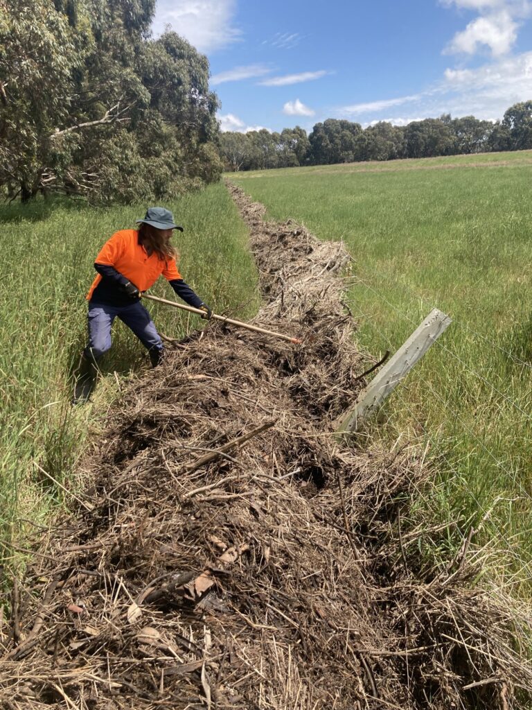
Funding will also cover immediate stream and waterway remediation and urgent repair and protection works are required to protect water quality and waterway health, including addressing significant erosion risks, debris and damage to related waterway health infrastructure.
These works include, but are not limited to:
- cleanup activities
- repairing and establishing erosion control structures (e.g. pile fields, drop structures, rock chutes)
- rock beaching and bank battering
- fishway repairs or realignment
- replacing habitat structures, including large wood
- repairing and/or replacing damaged riparian fencing and related infrastructure, including alternate water supplies
- vegetation management and weed control actions
- repair/replacement of environmental watering infrastructure sites, including regulators, pumps and monitoring stations
- repair/replacement of damaged recreational water assets and structures (e.g. fishing platforms, boat ramps, access paths and tracks).
Do you have flooding damage?
Do you live in the Glenelg Hopkins CMA catchment region, and need assistance in recovering from the flood, or have infrastructure damage that needs to be assessed?
Landholders need to log their damage with the CMA and we will arrange an on-site inspection.
To log your flood damage, call the CMA on 03 5571 2526
Please note: There is currently a large volume of inspections, and so it may take up to 2 weeks for the CMA to respond / conduct an inspection after logging the damage. If there is a need for immediate assistance, please let the staff know when you call.
What happened in 2016?
Significant rainfall in September 2016 – in some cases double the monthly average – caused much of the catchment to be with major flooding events. Twelve local government areas were affected by the September/October 2016 floods, with over 100 roads closed.
Aerial surveys indicated significant erosion had occurred as a result of the flooding at a large number sites across the region. Many sites that have suffered erosion were posing threats to public assets such as roads and bridges. All councils reported major infrastructure losses, stock, crop and fencing losses.
The Glenelg Hopkins CMA provided support at the Incident Control Centre in Heywood through these events, and has been involved in the Southern Grampians Shire-led multi-agency flood recovery group since the floods, contributing to the co-ordination of flood recovery activities in the region.
What did the CMA do?
Initial site inspections occurred at over 300 sites across the Glenelg Hopkins region in response to requests from affected land managers and the results of aerial surveys in the upper Glenelg and upper Hopkins catchments.
The CMA completed flood remediation works across 47 sites in the Glenelg Hopkins region through the Commonwealth and Victoria Governments Natural Disaster Relief and Recovery Arrangements (NDRRA). Works have included rock chutes, trickle pipe units, rock beaching, concrete structure repairs, pile field, woody revetment, coir log erosion control network, levees, crossing repairs and grassed chutes.
Additional funding was provided through the State Government’s Treasury Advance through DELWP. This enabled fencing and revegetation works to protect the erosion control structures constructed through the NDRRA, as well as an additional nine erosion control works, to be completed.
In addition to undertaking flood recovery activities, the project has been a pilot for new OH&S systems for use during field and construction works and run the first Cultural Heritage Awareness training for construction contractors for the Glenelg Hopkins CMA.
2016 flood images
 Wannon River in flood below Dunkeld
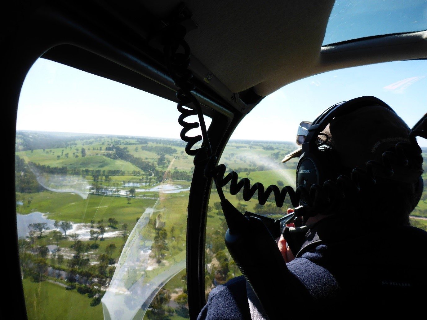 Glenelg Hopkins CMA undertaking aerial surveys in the upper Glenelg catchment
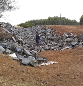 Completed rock chute
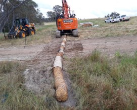 Coir log network in progress
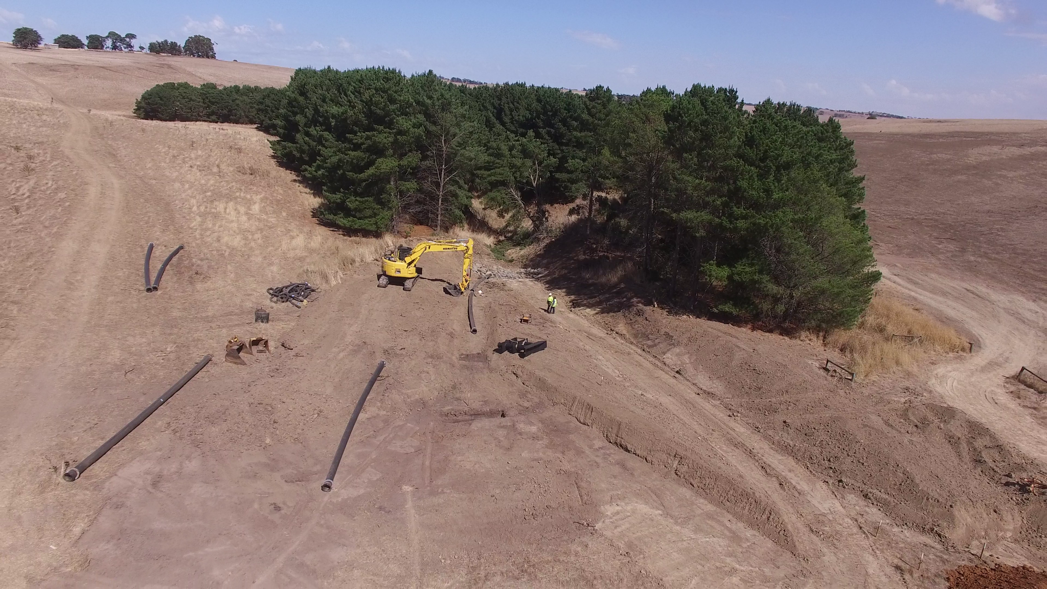 Trickle pipe unit being installed
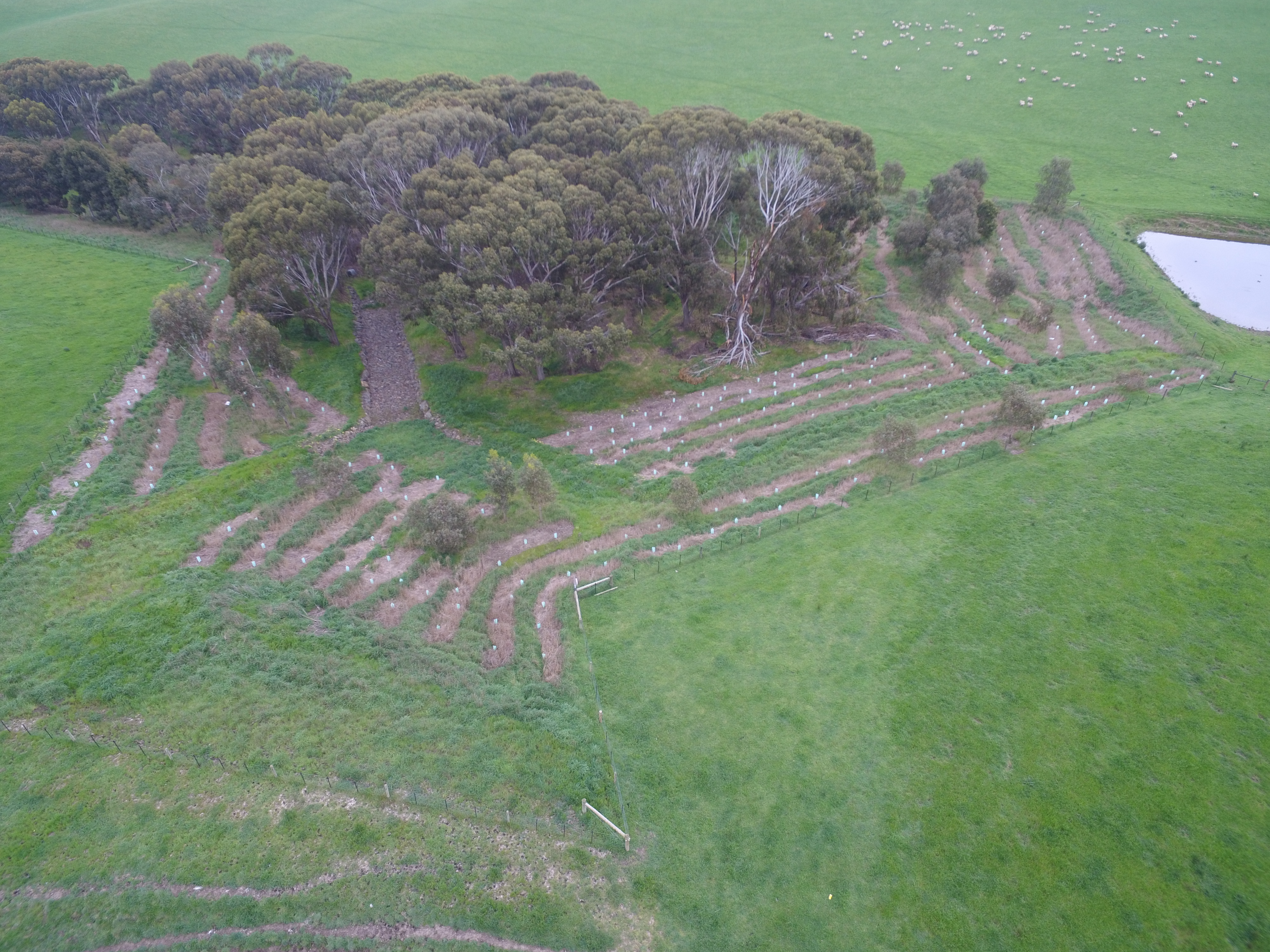 Revegetation at rock chute
Project Partners
Private land managers, Local Government, DELWP, VicRoads, forestry companies and traditional owner groups.
The Glenelg Hopkins CMA’s NDRRA AGRN728 Flood Recovery Project is jointly funded by the Commonwealth and Victoria Government under the Natural Disaster Relief and Recovery Arrangements.