Glenelg Estuary and Discovery Bay – Glenelg Ramsar
What is the Glenelg Ramsar area?
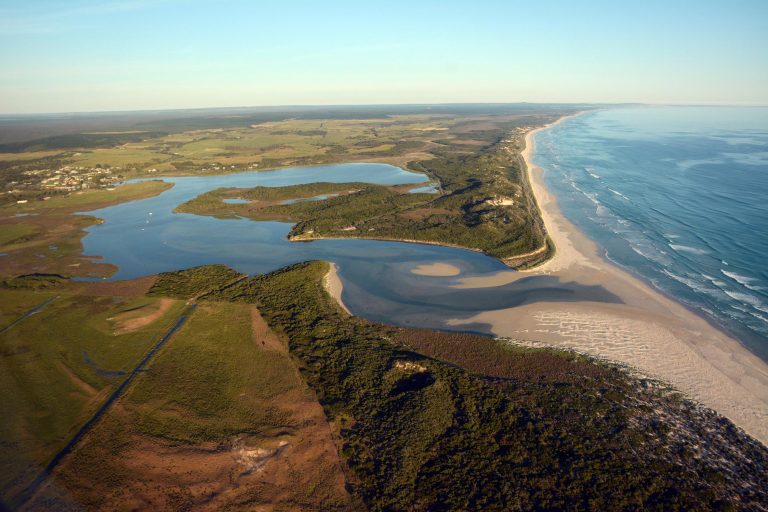
The Glenelg Estuary and Discovery Bay is Victoria and Australia’s newest Ramsar site – Glenelg Ramsar – and was gazetted as a Wetland of International Significance in August 2018.
A Ramsar listing provides additional protection for highly significant wetland values, raises the national and international profile of these wetland values and increases the level of management and funding support for this area. The Ramsar site includes the majority of Lower Glenelg National Park and Discovery Bay Coastal Park.
How is the Glenelg Ramsar area managed?
The management activities undertaken on, in and around the Glenelg Estuary and Discovery Bay Ramsar site are guided by the Management Plan (Glenelg RMP). The first management plan was developed following the area’s Ramsar gazettal and covered the period 2020-2024.
In 2025, the Glenelg Hopkins CMA, as the Ramsar site coordinator, updated the management plan.
2025-2032 management plan updates:
- Updated Risk Assessment – Using the latest science and stakeholder input to identify priority threats and management actions.
- Refined Resource Condition Targets (RCTs) – Clear goals for maintaining ecological character and monitoring progress.
- Management Strategies for 2025–2032 – Actions to address high-priority threats such as invasive species, climate change impacts, and wetland diversity and condition.
- Adaptive Management Framework – A mid-term review after four years and a strong focus on monitoring, evaluation, reporting, and improvement (MERI).
- Integration of Traditional Owner Knowledge – Strengthening partnerships with Gunditjmara and Buanditj Traditional Owners to embed cultural values and practices in site management.
Key Priorities
- Protecting Ecological Character – Maintain critical wetland types, threatened species, and migratory bird habitats.
- Managing Threats – Address invasive species (foxes, pigs, weeds), agricultural runoff, and climate change impacts such as sea-level rise and reduced freshwater inflows.
- Community Engagement – Support citizen science, education programs, and local stewardship initiatives.
- Cultural Heritage – Work with Traditional Owners to care for Country and incorporate cultural knowledge in management.
Read the 2025-2032 Site Management Plan (PDF)
Management Plan Background
The Glenelg Ramsar Management Plan provides a focus for management strategies to protect site values and that support the unique ecological character of the area. Parks Victoria, as the Site Manager, will work on behalf of the Department of Energy, Environment and Climate Action (DEECA), the Crown Land Owner, through collaboration with Glenelg Hopkins CMA, the Ramsar Site Coordinator.
Together with other agencies (Gunditj Mirring TOAC, Southern Rural Water and Glenelg Shire Council) these agencies will implement management requirements for the Glenelg Ramsar site.
2025 Management Plan update
The Glenelg Estuary and Discovery Bay Ramsar Site is internationally recognised for its unique wetlands, diverse habitats, and cultural significance.
In December 2025, the Ramsar Site Management Plan (RSMP) was renewed to guide the protection and wise use of this important site over the next seven years. This update continues the Victorian Government’s obligations to meet Australia’s Ramsar Site Management Principles.
What’s new in the Ramsar Site Management Plan 2025-2032?
- Updated Risk Assessment – Using the latest science and stakeholder input to identify priority threats and management actions.
- Refined Resource Condition Targets (RCTs) – Clear goals for maintaining ecological character and monitoring progress.
- Management Strategies for 2025–2032 – Actions to address high-priority threats such as invasive species, climate change impacts, and wetland diversity and condition.
- Adaptive Management Framework – A mid-term review after four years and a strong focus on monitoring, evaluation, reporting, and improvement (MERI).
- Integration of Traditional Owner Knowledge – Strengthening partnerships with Gunditjmara and Buanditj Traditional Owners to embed cultural values and practices in site management.
Key Priorities:
- Protecting Ecological Character – Maintain critical wetland types, threatened species, and migratory bird habitats.
- Managing Threats – Address invasive species (foxes, pigs, weeds), agricultural runoff, and climate change impacts such as sea-level rise and reduced freshwater inflows.
- Community Engagement – Support citizen science, education programs, and local stewardship initiatives.
- Cultural Heritage – Work with Traditional Owners to care for Country and incorporate cultural knowledge in management.
Consultation cutcomes around updating the management plan
Public consultation was held from 19 June to 18 July 2025 via Engage Victoria and local workshops. Key feedback included:
- Improved Communication – Stronger engagement with local communities and stakeholders.
- Support for Citizen Science – Greater opportunities for community involvement in monitoring and on-ground actions.
- Clarity on Threats and Achievements – Requests for clearer information on risks (e.g., recreation, groundwater) and reporting on progress since 2017.
- Legislative Context – Suggestions to strengthen references to relevant policies and obligations.
In response, the final RSMP includes:
- Enhanced communication and engagement strategies.
- Incorporated lessons learned from previous implementation.
- Updated tables, explanatory text, and management strategies to reflect community input.
Why It Matters
The Glenelg Estuary and Discovery Bay Ramsar Site supports:
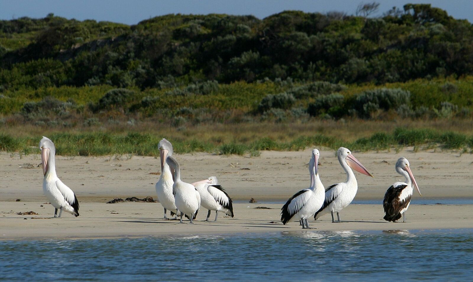
- Rare wetland types and geomorphic features .
- Threatened species such as Australasian bittern, hooded plover, and Yarra pygmy perch.
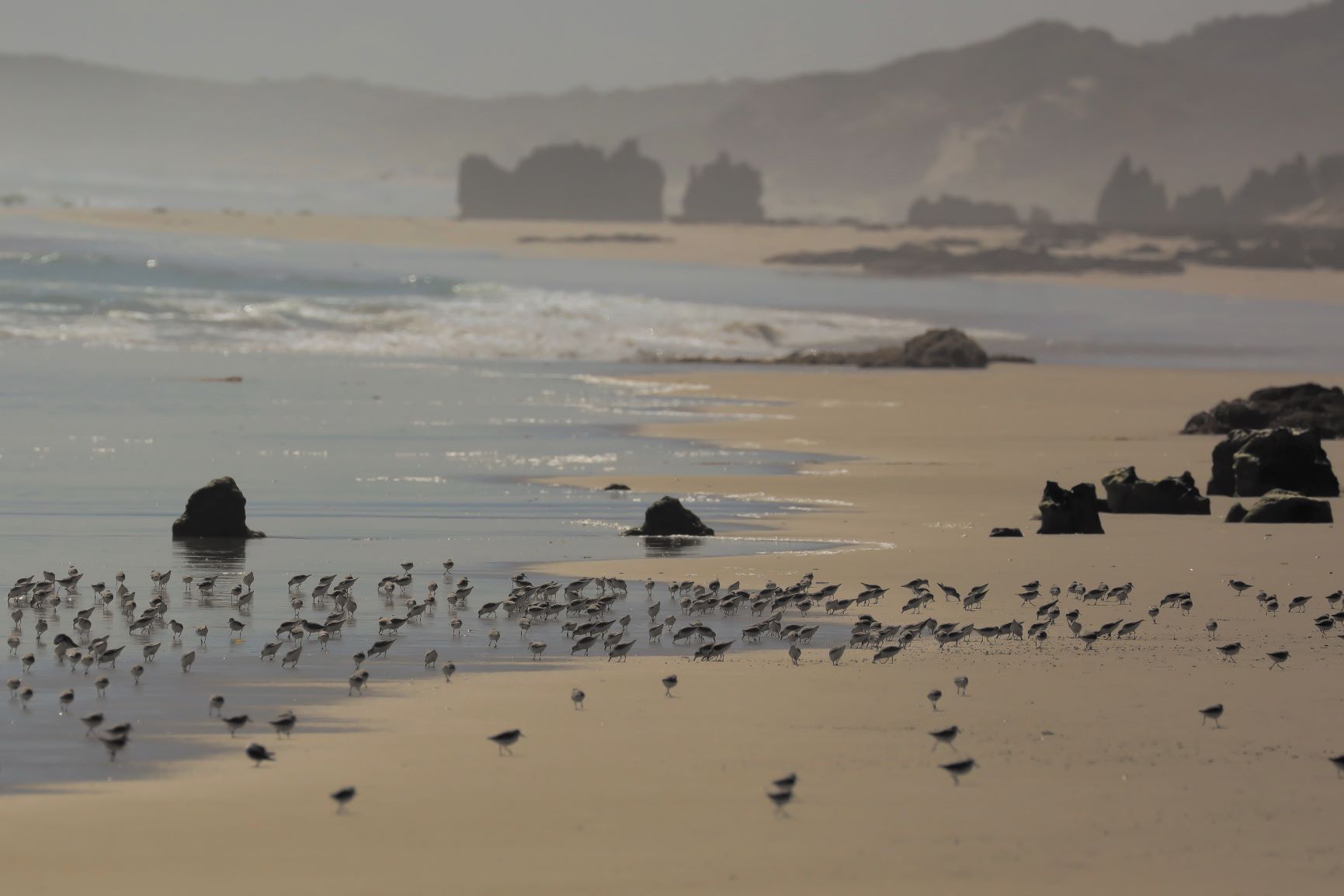
- Migratory shorebirds including sanderling, which rely on the site for feeding and roosting.
- Cultural heritage and ongoing connection to Country for Gunditjmara and Buanditj peoples.
Read the 2025-2032 Glenelg Ramsar Site Management Plan (PDF) here
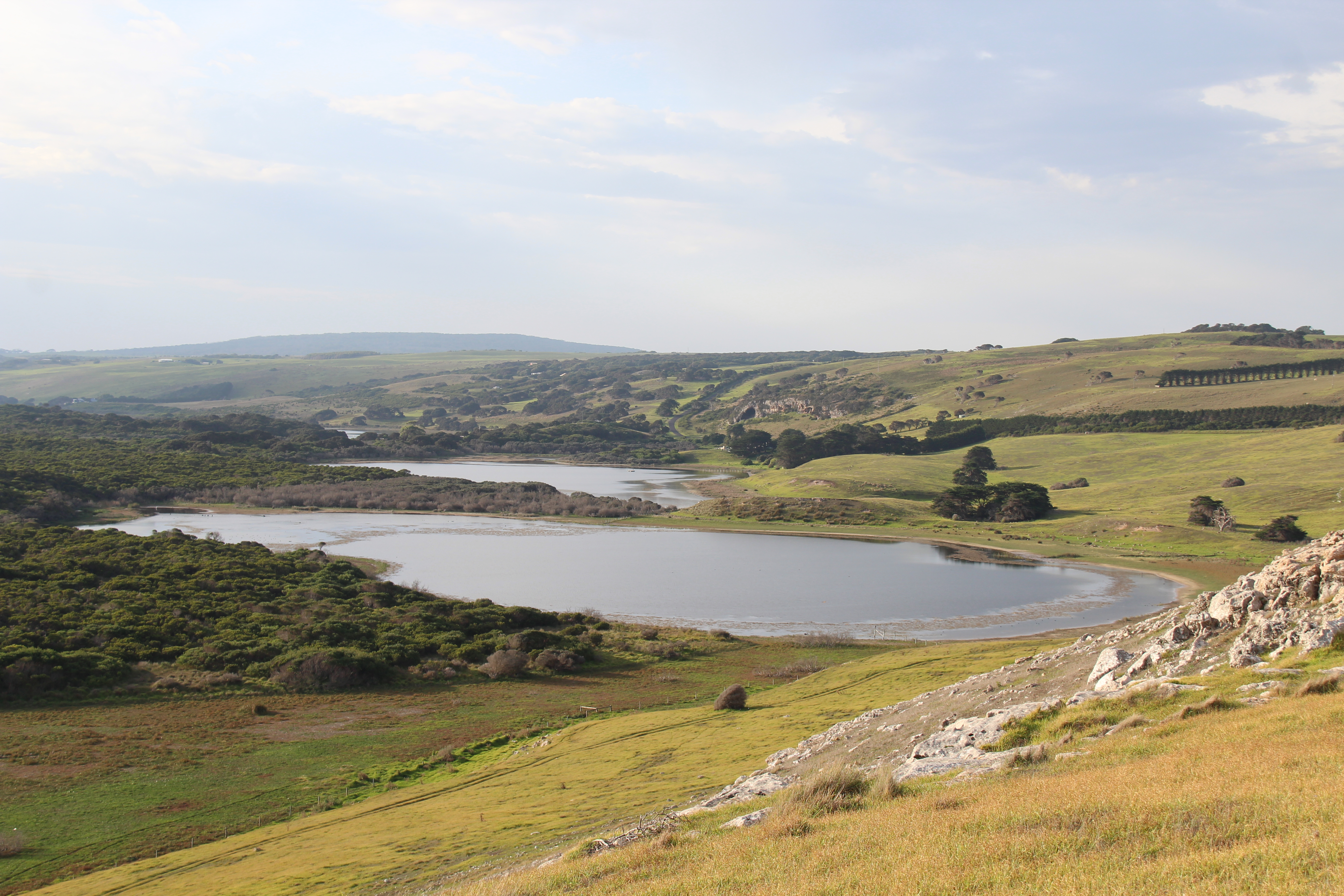
What’s in the Ramsar area?
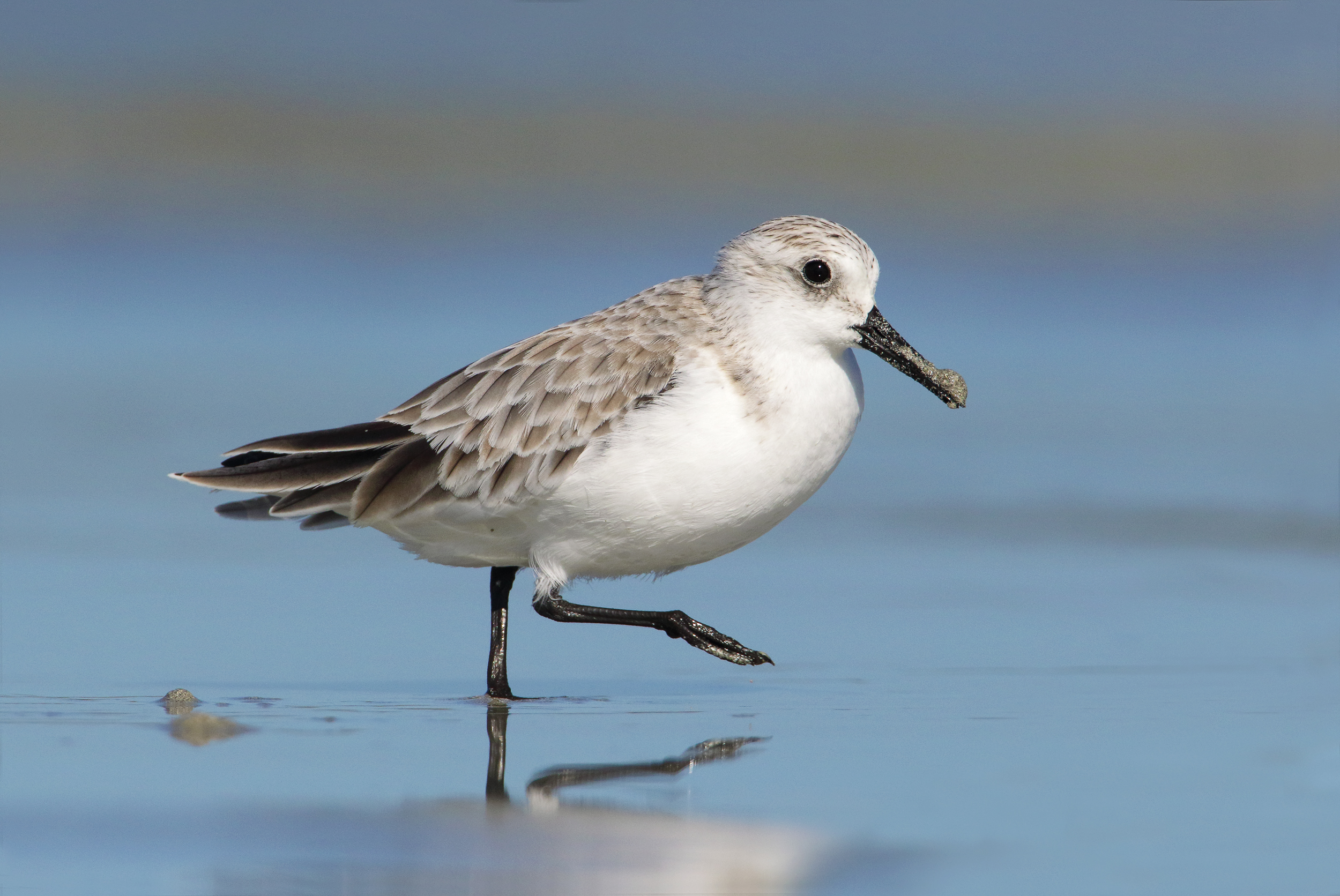
Sanderling tracking project
The Discovery Bay Sanderling Tracking Project began in 2020.
This project is a community-initiated project to identify the habits of the Sanderling birds who arrive on the southern shores of Australia each Summer and focusses on the Discovery Bay area of south-west Victoria, and the beaches of south-east South Australia.
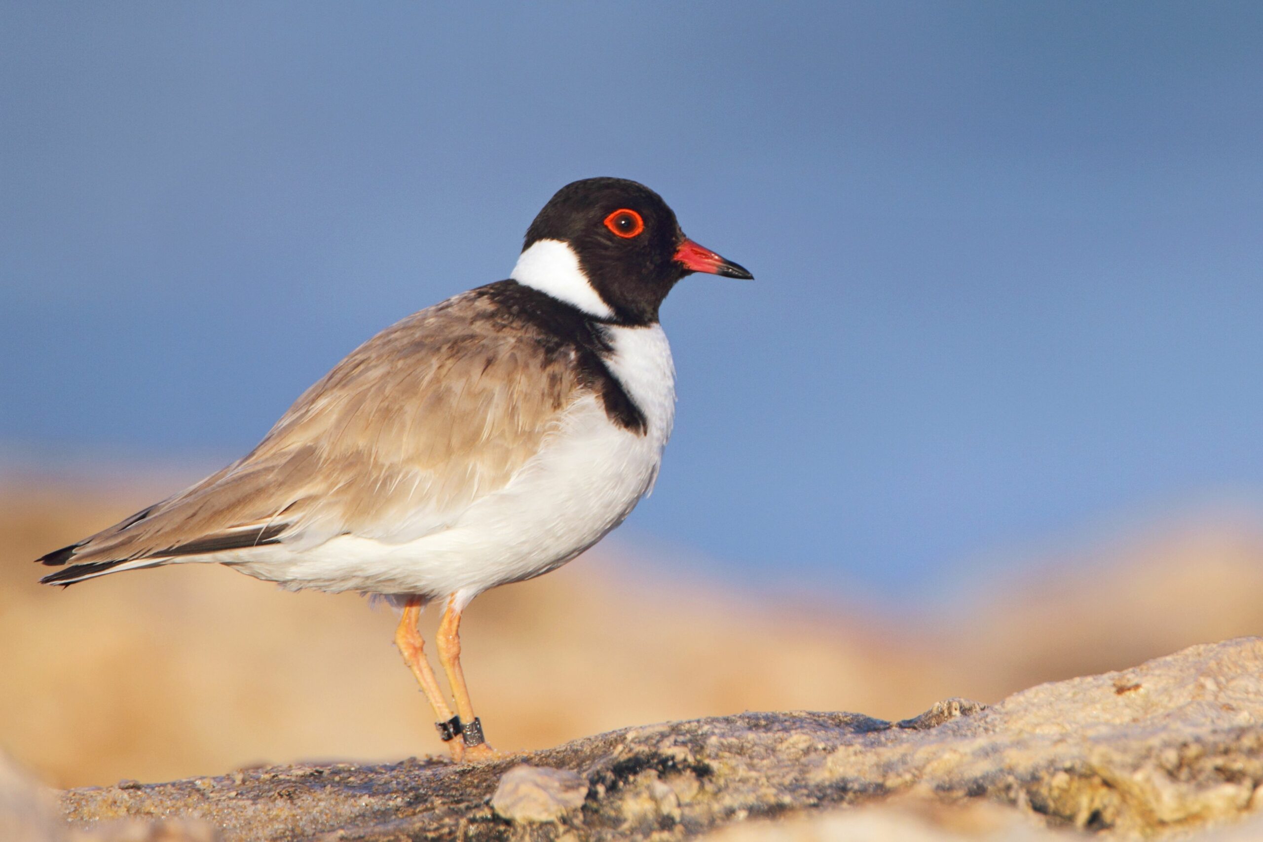
Heads up for Hoodies
This super cute little beach bird, the Hooded Plover, is at risk in its natural habitat thanks to some people not respecting its nesting sites. As such, a number of projects have begun to educate people about the Hooded Plover and how simple things, like keeping your dog on a lead at the beach, can help protect it during nesting season.
LIVESTREAM VIDEO: Visit the Glenelg Estuary
Back in 2021 when most of the State was in Covid lockdowns, there was the opportunity to take advantage of being in the regions – where limited outdoor activities could occur – and we could broadcast a livestream from the Glenelg Estuary at sunset for the Victorian Nature Festival.
What happens in the Ramsar area?
Since the the creation of the Ramsar area, the Glenelg Hopkins CMA has worked closely with agencies to continue to improve the Glenelg Estuary and the range of values it supports, including public infrastructure and the ability of the community to be able to enjoy the social and environmental values of the area.
The Glenelg Hopkins CMA is the Ramsar site coordinator for projects and activities within the Ramsar area. This includes on-ground activities like species monitoring, pest plant and animal eradication, waterway management and biodiversity support.
To further understand how the area is managed, you can refer to the Glenelg Estuary Discovery Bay Management Plan 2025-2032 (PDF)
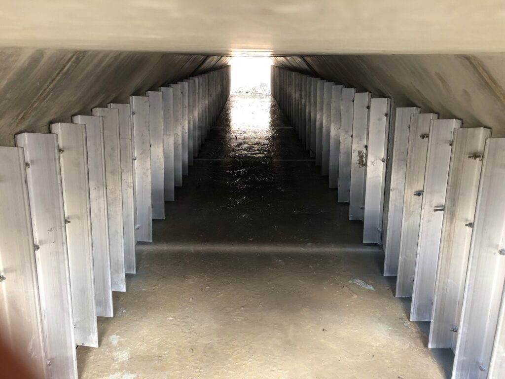
In 2024 the Glenelg Hopkins CMA undertook a project to raise the level of Beach Road, the main access road along the wetland and esturine swamp areas of the lower Glenelg between the township of Nelson and a lookout over the Glenelg River mouth area.
The low-lying existing road was prone to flooding then when estuary filled as part of the natural process of the Glenelg River being an intermittently closed river mouth.
The road and its dated culverts inhibited water flow and fish passage around the wetland areas and contributed to community frustration around access.
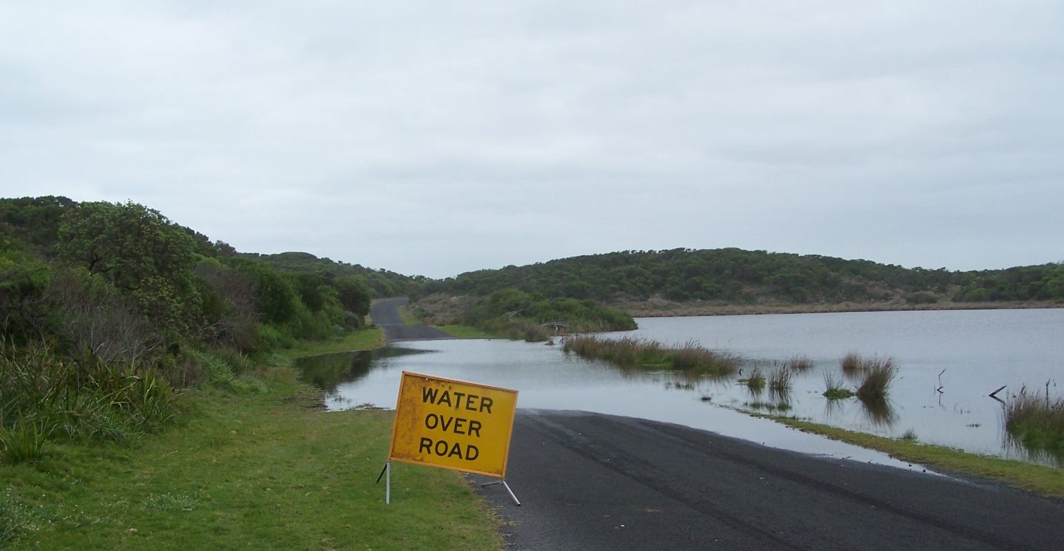
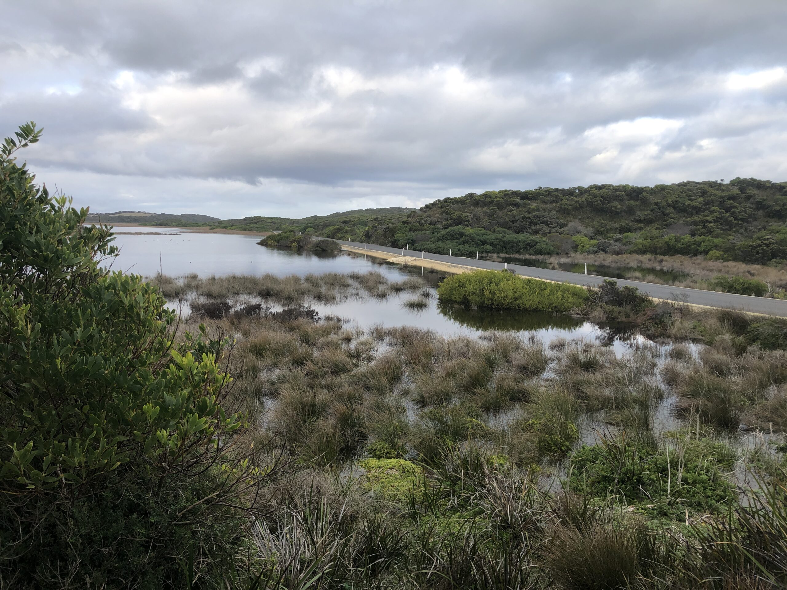
Fish friendly culverts were placed under the new road to allow for passed under the road as estuary levels fluctuated.
Glenelg Estuary and Discovery Bay wetland Complex – Ramsar nomination
What’s happened in the first 12 months of Ramsar?
Anniversary celebrations and community forum
As a celebration of the first 12 months of the Glenelg Estuary Discovery Bay area as a Ramsar-listed site a community forum was held in November 2019.
This event allowed environmental managers, Traditional Owners, environmental support organisations and others involved in the management of the area to update the community on what had been achieved and discovered in the preceding 12 months, and the plans going forward.
It included outcomes from monitoring projects, as well as discussing the impacts to the local economy, tourism the environment. One of the projects to be discussed will be the monitoring of the population of Tupong and the relationship to and wetland connectivity on improving numbers.
Other topics discussed included Nature Glenelg’s Trust management of Long Swamp restoration, endangered species research findings, as well as the importance of ecological literacy for future generations.
Find out more
All of the community forum presentations were recorded. You can watch the videos created from the presentations from that community forum below or on our YouTube channel
RAMSAR Site Coordinator
Glenelg Hopkins CMA
Email